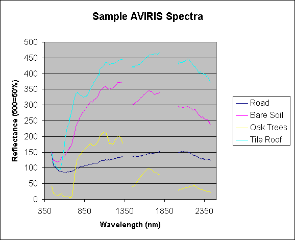
Airborne Visible InfraRed Imaging Spectrometer (AVIRIS) data acquired over Santa Barbara, CA in October 1999 are being used in this research. These data have a spatial resolution of approximately 4 meters and measure 224 contiguous spectral bands with wavelengths from 400 to 2500 nanometers (nm). These highly detailed surface reflectance measurements result in thousands of unique spectra across the landscape, allowing one to distinguish among subtle differences in the urban and natural environment. For example, the following graph plots reflectance measurements from various vegetation, soil, and urban surface materials:
As indicated by the plot, each cover type has a unique "spectral signature" because each material reflects light differently across the spectrum. Remote sensing aims to utilize this information to group and map land use and cover across the landscape. The gaps in the data represent wavelengths where atmospheric absorption causes the measured signal to be too noisy to be useful. For more information about AVIRIS instrumentation, atmospheric absorption, data availability, and research, visit the AVIRIS Home Page.
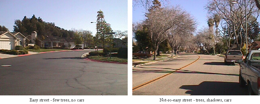
An additional limitation of remote sensing is that it provides a birds-eye view of the ground. Therefore, if a large tree canopy covers a house or part of a road, the imagery only has the ability to represent that area as a tree. Depending on the particular characteristics of the road being mapped and on the surrounding environment, there will be differences across the landscape in the ease at which roads can be extracted. For example, the pictures below present two major differences in terms of one's ability to map a road successfully with remote sensing in that area. The picture on the left shows an area that road extraction from remote sensing would be straightforward and relatively simple. The picure on the right shows a much more complex environment with trees, cars, and shadows that would affect the spectral signature of the road on a pixel to pixel basis. This research aims to successfully extract roads from various levels of complexity, although we anticipate that in some areas the roads will be "lost" under a tree canopy.
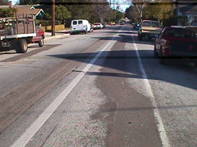
Pavement repair areas also present a challenge where road materials vary on a scale of only a few feet. For example, the following picture shows an area that quickly transitions from one pavement type to another and back again, with bike lane paint and shadows adding yet more complexity to this small area:
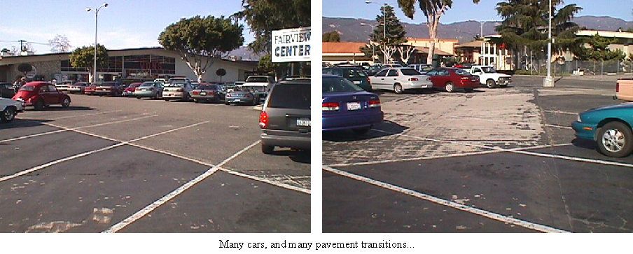
A final example of complex paved surfaces is that of parking lots. Because reflectance imagery must be taken midday, parking lots contain an infinite combination of cars and pavement presenting a diverse array of reflectance signals. The following pictures illustrate the complexity seen in just a single parking lot:
Given these scenarious, it is important in this project to recognize the complexity of the problem being addressed: that of picking out road pixels from a diverse, ever-changing and transitional urban landscape.
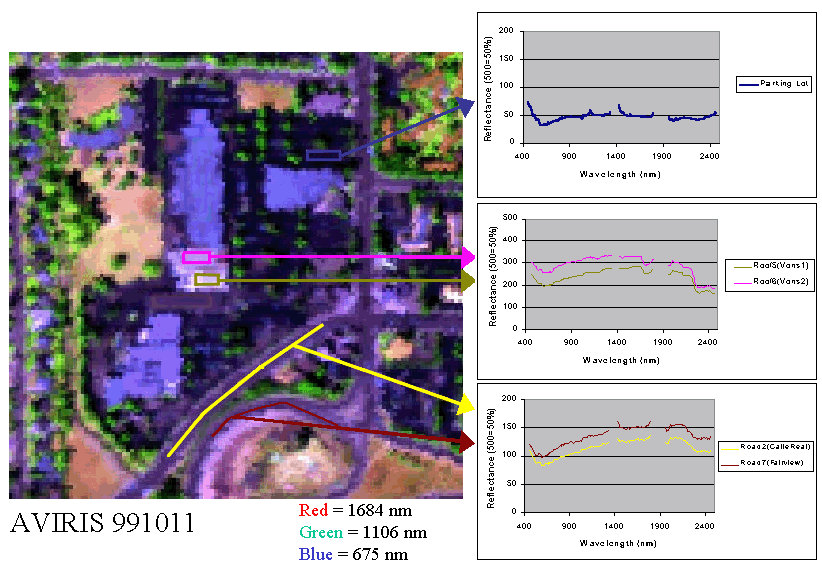
The following example shows a small subset of the AVIRIS imagery and the ROIs defined for different urban materials:
The most recent spectral library developed for this project contains
over 130 averaged spectra from field-identified ROIs. A breakdown of the
materials contained in the library is indicated in the following table.
You may view spectral plots by clicking on the categories under the "Library
Spectra Plots" column. You may also download the library in either
Excel (99ver2-2.xls)
or ENVI (991011_1_ver2.lib
& 991011_1_ver2.lib.hdr)
format.
in Current Library | |
An additional obstacle in utilizing remote sensing data for road extraction beyond the mixed pixel problem is spectral confusion of roads with other cover types such as roofing materials. Because different road and roofing types contain similar substrates and bituminous materials, they reflect light very similarly. Additionally, both roofing materials and roads change as they become weathered, causing differences in the way they reflect light over time. Therefore, some major challenges are being addressed in this research. One approach that we are presently exploring is the use of both spectral and spatial information in extracting road features. With this technique, we will map road features to the best of our abilities with spectral approaches such as MESMA, and then process the resulting map with spatial filters that pick out contiguous and linear features as roads.
Once the technique is well defined for use with AVIRIS, the imagery can be degraded spatially and spectrally to simulate other, widely available image data. This will allow us to assess the data requirements for this technique to be used on the large-scale in developing low-cost, accurate, and up-to-date road maps.