Research — Security and CIP
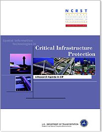
Research Agenda
 Our research agenda of April 2002 is based on an open consultation with CIP
professionals (this is ongoing and you are encouraged to participate).
It identifies two principal thrusts: (a) cooperation and support, and (b)
basic and applied research.
Coordination, Cooperation and Support Program
- Prototype RS/GIS applications for disaster management.
- Expose the Transportation, Disaster Management and First Responder
communities to RS/GIS technology and techniques common to all three groups.
- Develop information use scenarios, including roles, responsibilities
and information flows, incorporating the role of new technologies, e.g. GPS,
wireless communication devices.
- Develop cost and benefit models, and demonstration projects in cooperation
with high profile jurisdictions
Basic and Applied Research Program
- Develop a theoretical framework linking disaster type with specific
information needs and RS data sources encompassing the Disaster Management
Functional Cycle (i.e., planning, response, recovery and mitigation).
- Develop a spatial framework, a systematic methodology and statistical
measures for analysis of risk and vulnerability of the CTI.
- Develop methods and standards for communicating and visualizing risk
and vulnerability of the CTI.
- Develop a spatial framework, a systematic methodology and statistical
measures for the determination of disaster consequences.
- Develop change detection methods and tracking mechanisms for specific
disaster types (e.g., terrorist attack).
- Develop RS/GIS based models of critical infrastructure interdependencies.
- Develop rapid deployment RS/GIS data collection technologies such
as fixed tethered balloons and unmanned aerial vehicles (UAVs) to monitor
rapidly changing disaster conditions (e.g., spatial extent of disaster area,
toxic plumes, fire propagation, flooding, evacuations and population displacements).
You are welcome to download and duplicate the agenda.
 Our research agenda of April 2002 is based on an open consultation with CIP
professionals (this is ongoing and you are encouraged to participate).
It identifies two principal thrusts: (a) cooperation and support, and (b)
basic and applied research.