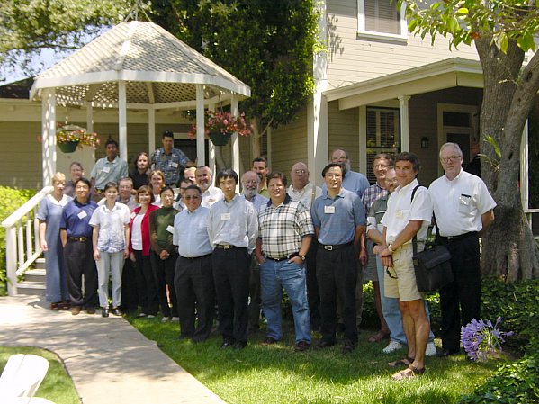
 CLEM2001
was a grand success. We were fortunate to attract an excellent roster
of participants, not just in terms of intellectual level, but just as importantly,
their readiness to share ideas. The agenda was divided into three
broad sections:
CLEM2001
was a grand success. We were fortunate to attract an excellent roster
of participants, not just in terms of intellectual level, but just as importantly,
their readiness to share ideas. The agenda was divided into three
broad sections:
CLEM2001
was a grand success. We were fortunate to attract an excellent roster
of participants, not just in terms of intellectual level, but just as importantly,
their readiness to share ideas. The agenda was divided into three
broad sections:
The conclusion from the meeting was that there is no fully automated remote sensing solution on the horizon. We may look at it as an essentially human process with automated assistance, or an automated process with human assistance. Mike Goodchild's closing presentation drew out those conclusions. There was a general intention to broaden the community and to meet again in 2 years. In the meantime we will sustain interest in the exchange of ideas by means of a web based discussion forum, to be announced shortly.
Announcement and some background
|
Welcome Notes Val Noronha Project Director, NCRST-Infrastructure, University of California, Santa Barbara, USA Centerlines are required
in a broad range of applications, from market research (where 1:100,000
scale and 50m error will do) to school busing and election planning (where
it's important to know on which side of a street an address is), emergency
services (20m) and precision snow plowing (10cm). There are a variety
of centerline mapping methods: field survey at the centimetre level, collaging
CAD plans, GPS (5-20m), remote sensing and digital conversion of maps at
different scales. There is no universally "right" method, but there
are application niches associated with each approach. Some are faster,
some cheaper, some more accurate; some apply to urban streets but not rural;
some are compromised by urban canyons or tree canopies. CLEM2001
is an opportunity to bring together some of the leading researchers in
the field, to see if we can learn from each other and expand the domain
of our solutions.
|
| Measuring
Accuracy of Street Centerline Datasets
Donald Cooke Founder, GDT, Lebanon NH, USA While everybody would like
a street database "as accurate as possible", few people have spent much
time systematically measuring positional accuracy of datasets such as TIGER
or commercial street files. This situation is exacerbated by huge
variations in positional accuracy of individual components in evolving
datasets such as TIGER, and because we happen to be on a cusp between using
scale-based descriptions of accuracy such as the National Map Accuracy
Standard (NMAS) and the recently adopted (1998) National Standard for Spatial
Data Accuracy (NSSDA). This paper describes Geographic Data Technology's
experience in measuring accuracy of TIGER and GDT's proprietary "Dynamap"
dataset. It presents results of exhaustive and continuing positional
accuracy tests of street centerline files before and after positional accuracy
enhancement using a variety of techniques and sources.
|
| MAF/TIGER
Modernization
Robert A LaMacchia Assistant Division Chief, Geography Division, U. S. Census Bureau, Washington DC, USA The U. S. Census Bureau,
in cooperation with the U. S. Geological Survey, developed the nations
first street centerline file (TIGER) for use in the 1990 decennial census.
The Census Bureau is embarking on a program to modernize the MAF/TIGER
system to support the use of GPS-enabled hand-held devices by its field
staff. The Census Bureau believes it requires a street centerline
file and a coordinate for every housing unit at 3-meter or better accuracy
to support this objective. The Census Bureau has two projects underway
utilizing imagery to realign TIGER/Line files and obtain structure coordinates.
|
| A
Comprehensive Survey of Extraction Techniques of Linear Features from Remote
Sensing Imagery
Raad A Saleh Scientist, Civil and Environmental Engineering, University of Wisconsin-Madison Madison WI USA Research on automated and
semi-automated extraction techniques of linear features from remote sensing
imagery has been active for decades. Features of interest include
transportation networks, power transmission lines, etc. This paper
presents a comprehensive survey of extraction techniques of such features
from aerial and satellite imagery. The techniques are evaluated with
respect to methodology, strengths, drawbacks, and implementation approach.
Source data for the surveyed techniques include panchromatic and multispectral
imagery. The viability of hyperspectral data is extrapolated for
same purpose of utilization. The paper later presents a discussion
of automated extraction techniques specifically used for updating road
spatial databases.
|
| Automatic
Feature Recognition and Extraction from Remote Sensing Imagery
Edward F Granzow Principal, Iguana Inc, Crystal Bay NV, USA |
| Optimization-based
method for road network extraction
Demin Xiong Staff Research Scientist, Center for Transportation Analysis, Oak Ridge National Laboratory, Oak Ridge TN, USA Road network extraction from
high-resolution images has significant applicability in transportation.
It provides a means for creating, maintaining, and updating transportation
network databases for many different purposes, such as infrastructure management,
traffic safety analysis, and traveler information and guidance. This paper
presents an automated procedure for road network extraction using optimization
and supervised classification techniques. In order to establish a basic
understanding of existing methods and approaches, the paper first summarizes
important research efforts on the subject of road extraction. Then it provides
a brief discussion on road image characteristics, focusing on road image
intensity, image texture and geometric characteristics, which serves as
a modeling aid for the computer-based extraction. After that, a road extraction
method that uses dynamic programming and supervised classification is described,
and some experiment results are illustrated. Finally, strengths and
shortcomings of the proposed method and some future research directions
are discussed.
|
| UCSB
Centerline Research Overview
Val Noronha Project Director, NCRST-Infrastructure, University of California, Santa Barbara, USA |
| Mapping
Road Surfaces and other Urban Materials using Hyperspectral Data
Dar Roberts Department of Geography, University of California, Santa Barbara CA, USA |
| Global
road databases?
Chris Funk Graduate Researcher, Geography Dept, University of California, Santa Barbara CA, USA The centerline extraction
problem may be cast in an information theoretic context. Two general classes
of information are available from any image: spectral and spatial.
We demonstrate a novel filter technique that utilizes both classes of information.
Spatial analysis on-the-fly is carried out by building a q-tree data structure
on a pixel-by-pixel basis. This structure represents the local topology
of the road network. Connectivity of pixels is determined by a matched
filter distance metric using real spectra obtained by Dar Roberts and Meg
Gardner of UCSB. In this way the technique combines spatial and spectral
information to extract centerlines.
|
| Multispectral
Feature-Space Approaches to Change Detection and Road Extraction
Chris Chiesa Manager, GIS Technologies and Applications, Geospatial Production and Services Dept. Veridian Systems, Tucson AZ, USA Under funding from US DOT,
remote sensing researchers and software engineers at Veridian System have
refined change detection and feature extraction software for preparation
and maintenance of transportation databases. The resultant tools
have been incorporated into Classification and Feature Extraction - Transportation
(CAFE-T), an adaptation of Veridian's general-purpose ERDAS Imagine-based
CAFE toolbox. The Change Detection tools are typically used to screen
large areas using moderate-resolution imagery such as Landsat (15m to 30m;
7 spectral bands). The feature extraction tools, on the other hand,
target areas exhibiting high-densities of changes with higher-resolution
multispectral imagery such as IKONOS (1m to 4m; 4 spectral bands) for improved
characterization of the changes as well as extraction of new or modified
road network segments. Although the CAFE tools provide improved performance
over traditional manual methods in the identification of land changes and
associated road segments, the extraction and vectorization of these features
does not currently offer much additional benefit over manual extraction.
Through collaboration with other transportation remote-sensing researchers,
it is hoped that the efficiencies of the vectorization and clean-up routines
can be improved to levels similar to these associated with the identification
portion of the process. If this can be accomplished, the resulting
tools will significantly benefit large-area transportation database maintenance
efforts across the country.
|
| Alignment
Optimization and Quality Data
Peter Gipps R&D Manager, Quantm Ltd, Melbourne Vic, Australia The capacity of remote sensing
to produce quality data is running ahead of both the understanding and
ability of transport route planners to use it. The conventional road/rail
route planning process is predominantly intuitive, and the weakest link
is the planner's capacity to consider all data and the numerous constraints.
The Quantm system provides a method to unlock significant additional value
from the data through its comprehensive analytical capabilities.
The result is alignments that deliver better engineering and environmental
outcomes, and significantly reduce construction costs. The magnitude
and consistency of cost reductions are redefining the way that Australian
road agencies consider data, with the quality and scope of remote sensing
data becoming more attractive.
|
| Experiences
With Kinematic GPS Surveys in Developing Countries
Christopher Bennett Senior Pavement Management Specialist, Montgomery Watson New Zealand Ltd, Motueka NL, New Zealand Kinematic GPS surveys offer
major benefits to developing countries when it comes to characterising
their network for management purposes. For the first time it is possible
to quickly and cost effectively establish a road centreline. Over the last
18 months the World Bank has funded kinematic GPS centreline surveys in
the Philippines, Lao PDR and Samoa. This paper will present the results
of the surveys. It will address the technical issues -- such as differential
corrections and projections -- as well as the operational issues: how does
one execute a survey when the size and extent of the road network is in
many respects an unknown. It will also discuss the larger issue of data
accuracy: what is required for effective road management in developing
countries.
|
| Integrated
GPS/INS/CCD System for High-Precision Centerline Extraction
Charles Toth, Dorota Grejner-Brzezinska Research Scientist, Center for Mapping, The Ohio State University, Columbus OH, USA Department of Civil and Environmental Engineering and Geodetic Science, The Ohio State University, Columbus OH, USA The Ohio State University
currently is developing a GPS/INS/CCD integrated system for precise
(centimeter level) monitoring of highway center and edge lines. This research
is sponsored by the Ohio Department of Transportation. The prototype positioning
component of the system is based on a tightly integrated GPS/INS system,
and the imaging component comprises a single down-looking, high-resolution
digital camera. The high image rate provides sufficient overlap of the
subsequent images at highway speed, therefore stereo data processing is
expected to be performed in real-time with the support of on-the-fly navigation
solution.
|
| Use
of Vehicle Probe Data in Map Databases
Russell Shields, Yuka Gomi Ygomi LLC, Chicago IL, USA This presentation will outline
the use of vehicle probe data to achieve 100% accurate sub-meter map databases
for all roads in US, Canada, and Europe that will be in use by the end
of this decade. This data can be made available by the vehicle manufacturers
to help the needs of the infrastructure managers. The probe data
will be provided by vehicles from their advanced sensors for traction control,
stability, night vision, adaptive cruise control, collision avoidance,
road/lane departure prevention, etc. This data will be collected
by the vehicle manufacturers, assimilated, and broadcast back to vehicles
as part of their real-time picture of the road around them for use by active
safety products.
|
| Addressing
Multi-Centerline Representation Issues from a Transportation Engineering
Perspective
Kai Han Transport Information Group, University of Manitoba, Winnipeg MB, Canada Multi-centerline representation
of the divided highway provides more details and facilitates many transportation
applications. However, the complexity of multi-centerline representation
makes it unsuitable for network-related analyses, such as routing and some
types of traffic analysis. From a transportation engineering perspective,
the paper discusses issues related to multi-centerline representation.
It addresses issues encountered in practice through techniques developed
using a combination of commercial software, in-house programs, and database
queries. Issues include derivation of a single centerline from double centerlines,
relating single and multiple centerlines, and standardization of topology
directions. Finally, the paper concludes with the observation that it is
ideal to include both representation schemes into a suite of interoperable
GIS-T base maps and have them work together to satisfy specific needs of
transportation applications.
|
| UNETRANS:
essential data model for transportation
Kevin M Curtin Department of Geography, University of California, Santa Barbara CA, USA |
| Roadway
Centerline and Feature Extraction Using Aerial Remote Sensing and Photogrammetry
Ted Jones, Gay Hamilton Smith District Statistics Administrator, District Three Planning, Florida Department of Transportation, Chipley FL, USA President, HSA Consulting Group. Inc, Gulf Breeze FL, USA Although recognized as a
viable methodology, conventional aerial photography coupled with the photogrammetric
process has generally been ignored for widespread, frequent roadway data
collection because of cost considerations. To enhance interest in
traditional aerial photography and photogrammetry, we propose the following
application to extract accurate roadway centerline and feature data.
Although initial costs are significant, it will be demonstrated that leveraging
costs combined with a geospatial marriage of x,y,z coordinates with the
transportation linear referencing system will make the process beneficial
to multiple users. A proprietary tool enhances the centerline and
feature extraction process, and allows integration with van videologging
data and stereo imagery from a desktop personal computer.
|
| Where
have we come, where do we go from here?
Michael F Goodchild Department of Geography, University of California, Santa Barbara CA, USA |
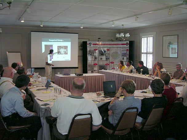 |
In session: Chris Chiesa presents |
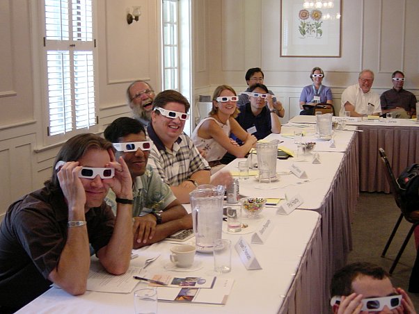 |
3-D boffins (as Chris Bennett might express it) scrutinize Gay Hamilton Smith's visuals |